
Don’t Be Scared, Just Be Careful
By Mark Chew
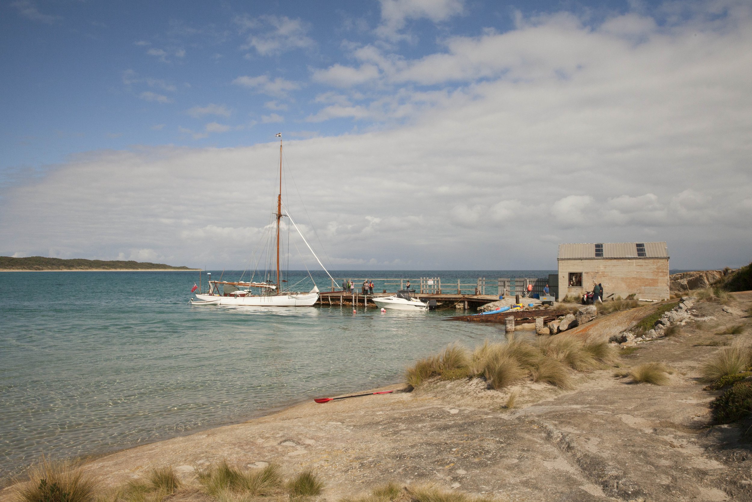
STORM BAY in Chimney Corner, Three Hummock Island,
Courtesy of The Wooden Boat Shop
Justifiably, Bass Strait has a horrible reputation. As the water from the Southern Ocean travels into the strait, the depth rises from 5 kms, just west of King Island, to around 50 meters across most of the Strait.
Add to that, funnelling winds and significant tidal flows and it’s never going to be a cruising ground for those who are in a hurry or don’t want to do their homework. But it seems to me that wooden boat owners, perhaps more than others seem to understand that rushing is not always good, and that good preparation provides rewards that aren’t available to those who stick to the shiny marinas springing up around our coasts.
With that in mind here are five of my favourite Bass Strait hide-aways from West to East. They are not safe in all weathers, and a few of them need to be approached with care due to the tides and rocks, but once you’re safely anchored in a bay, in a boat that you love and trust, and the coffee is on the stove, and a seal comes over to say hello because you’re the only person around, then the crowded bays at Portsea, Port Arlington or Port Melbourne seem like a very poor alternative.
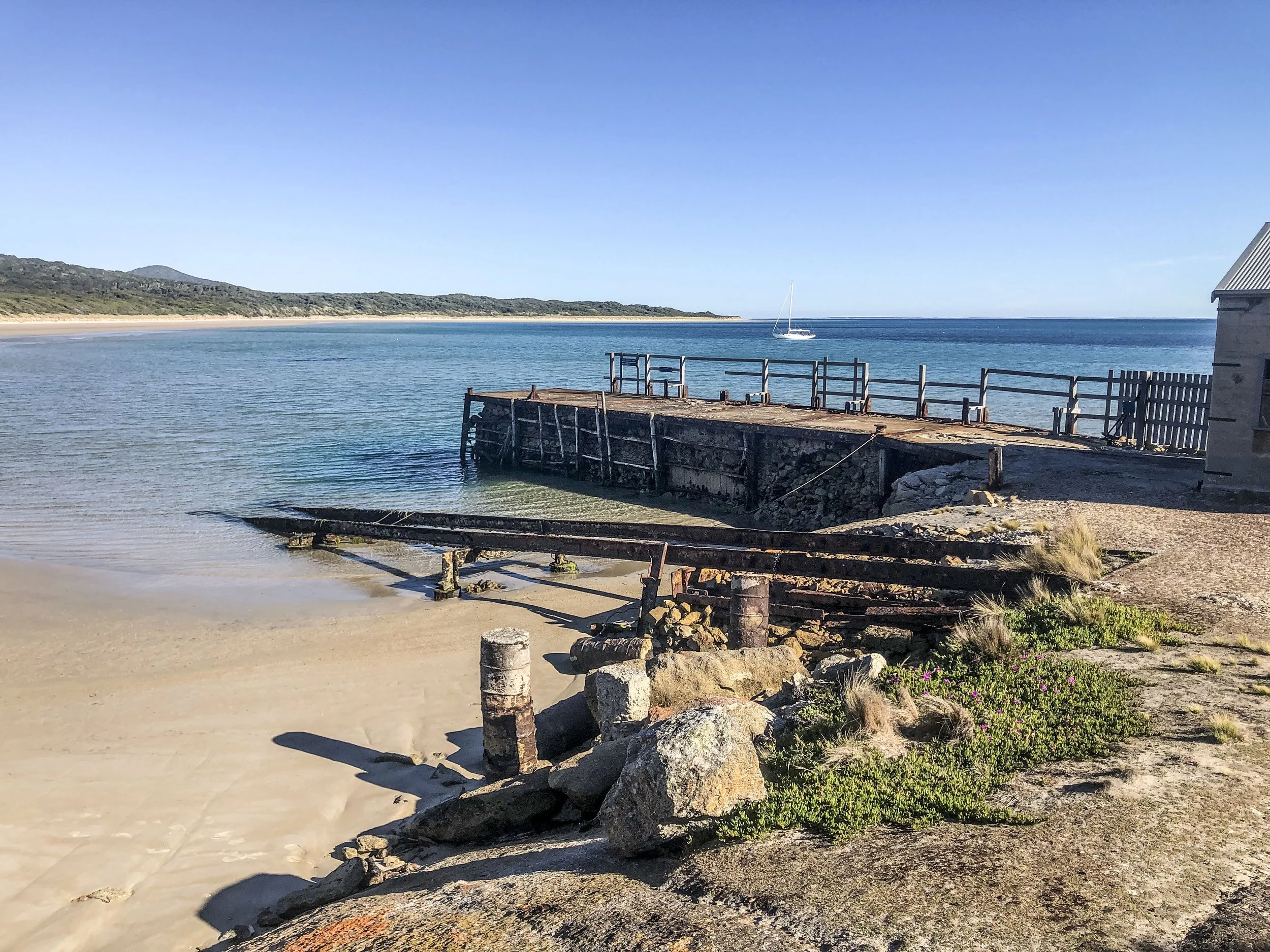
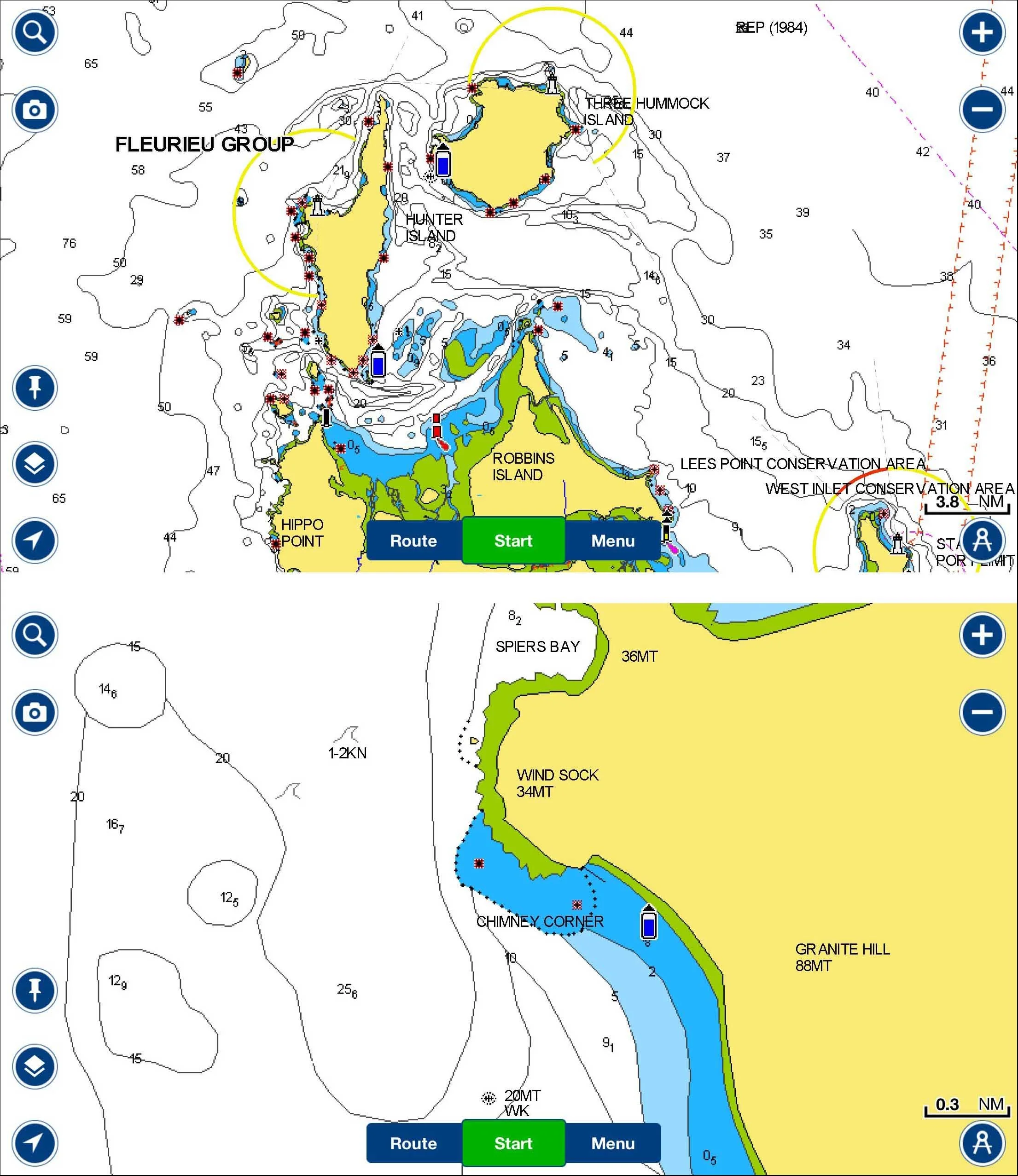
Chimney Corner, Three Hummock Island.
40 27.09 S 144 50.59E
43nm SE Grassy
130nm S Port Phillip Heads
30 nm NE of Stanley
Good Shelter from the NE through to S
There is a short, slightly tumbledown jetty here (depths marginal except at high tide)
and a remote house that is available for rent.
FAIR WINDS off the Jetty
Photo Mark Chew
The tide rips through Hope passage between Hunter and Three Hummock so plan the next leg of your journey to give you a slingshot. If the weather unexpectedly turns westerly you can head across to Shepherds Bay which might be a bit a bit roly but should be safe. The Island itself is truly beautiful with sculptural granite boulders and pristine beaches. If you really must…there is patchy internet from up near the windsock. The caretakers of the accommodation are helpful and up for a chat as long as they are not too busy preparing for the next batch of visitors (max 8) to arrive in a tiny plane at the grass airstrip. It’s the only runway in the world that I have ever seem with a distinct dogleg half way along!
Good Landing, Great Glennis Island
39 04.88 S 146 13.95E
88nm ESE Port Phillip Heads
11nm W of Refuge Cove ( 17nm by sea)
Good Shelter from the W through to S
This remote anchorage provides a majestic alternative for those who have been to Refuge Cove a bit too often. The island was sighted by Lieutenant James Grant, in Lady Nelson, on 10 December 1800 and named "after Mr. George Glennie, a particular friend of Captain Schank’s, to whom I was under personal obligations”

The MARGARET PEARL lying snugly in the Bay at Great Glennis
Photo Mark Chew
Ironically, given this bay’s name, trips ashore are not allowed as the Glennis are part of the Wilsons Promontory Islands Important Bird Area, identified as such by BirdLife International because of its importance for breeding seabirds. But don’t worry about that. The spectacular scenery will more than make up for the lack of time ashore, and if your desperate for a walk or the wind goes round to the east then Oberon Bay at Wilson’s Promentary is only 4nm away.

East Cove, Deal Island
39 28.32 S 147 18.59E
50nm SE Refuge Cove
99nm SSW of Lakes Entrance
99nm NNE Tamar River
Good Shelter from E round to S
This is a more popular refuge than the first two mentioned, as it’s more directly on the cruising passage route from Victoria to Tasmania and Tasmania to NSW, but even so it hasn’t lost its glorious remoteness, and although in summer there might be a couple of other boats there, its never going to be crowded.

FAIR WINDS in East Cove on Deal Island
Photo Mark Chew
There are two care takers who live on the island, for three month stints, and a beautiful small unattended museum. The walk up to the old disused lighthouse is a must. (the lighthouse was turned off in 1992 because the high elevation of the light caused visibility problems with low cloud 40% of the time. The keepers of the day at the Wilsons Promontory Lighthouse reported seeing the Deal island light on an average of only 6 nights in 10.) The passage between Erith and Deal (Murray Pass) can get ugly in wind against tide (which can run at up to 5 knots), and if the breeze comes in from the North or West,then an anchorage in West Cove off Erith is a better alternative. Holding at the northern end of the beach is questionable so stick to the southern end. This is what might happen if you don’t
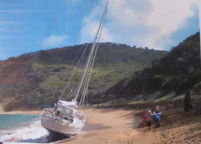
West Cove April 2010
The recent construction of a Telstra tower at Killiekrankie on Flinders Island has improved internet reception on Deal. Murray Pass and some of the areas around the Kent group are a restricted fishing zone so check the rules before you put a line down.
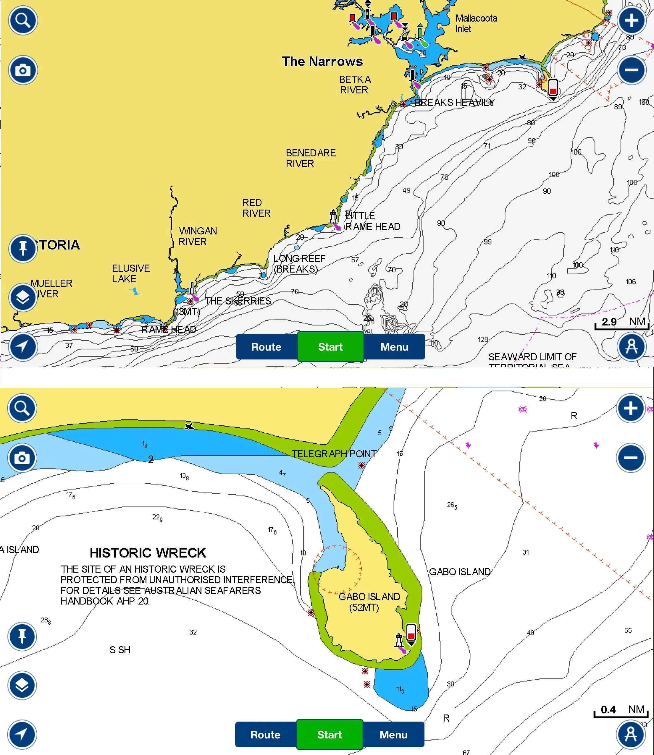
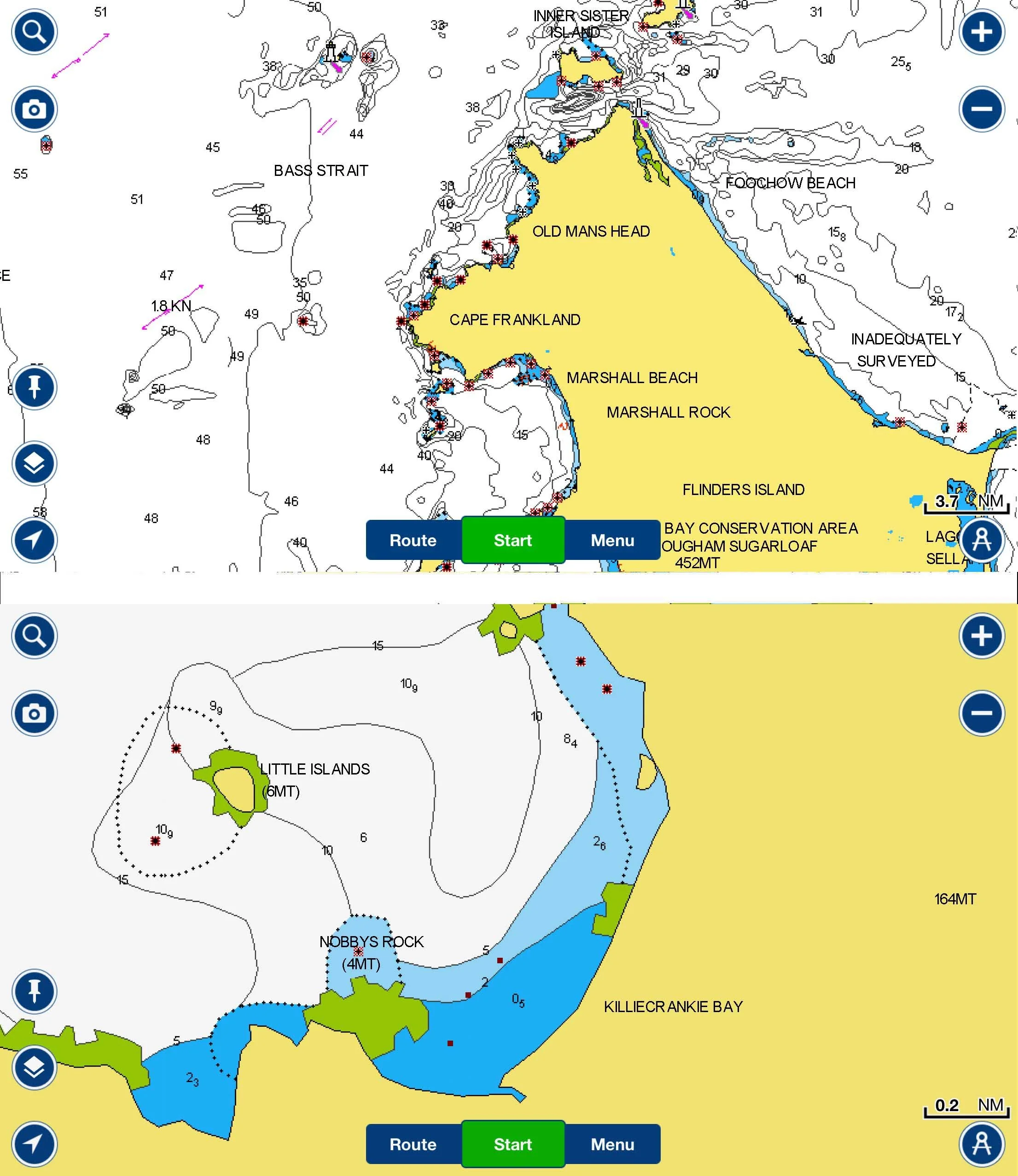
Killiekrankie Bay, Flinders Island.
39 49.85 S 147 50.29E
31nm SE Deal Island
88nm NE Tamar River
Some Shelter from the SW through to E but very exposed to W /NW
Perhaps the most tenuous of the 5 listed anchorages. Killiekrankie is a charming settlement with no shops but an interesting and thriving community. Crays fishing is an important part of life here and the corfs line the beach.
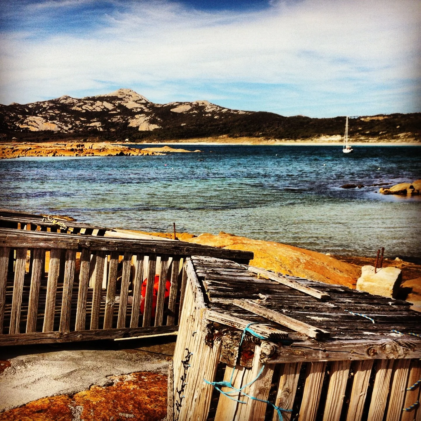
Cray corfs with FAIR WINDS behind in Killiekrankie Bay
Photo Mark Chew
There are a couple of moorings in the bay which might be available so ask around if you’re worried about your anchor. There is a great walking trail leading off the northern end of Killiekrankie’s long sandy beach, which takes you to Stackys Bight and a stunning rock arch, and if you are feeling energetic, a quick trip up Mount Killiekrankie will reward.
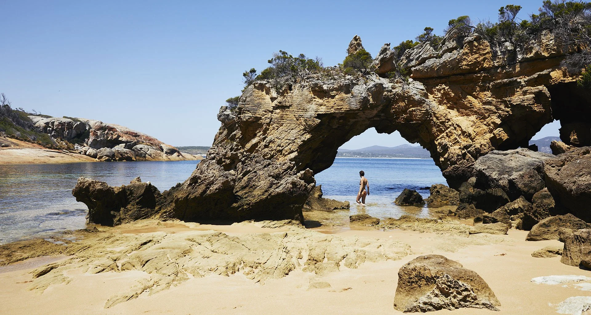
The rock arch in Stackys Bight
If the wind does come up from the north and west then your options are to head down to Prime Seal Island about 15 miles away or up the the Sisters at the Northern end of Flinders Island which is about 12 miles sailing.
Santa Barbara Bay, Gabo Island
37 33.43 S 149 54.46E
32nm S Eden
155nm NE Outer Sister Island
94nm E of Lakes Entrance
Shelter from the NE through to SE but expect a ground swell.
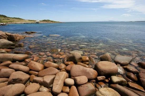
The pink granite of Santa Barbara Bay
It’s always a little further than I imagine from Gabo to the safety and pleasures of Twofold Bay and Eden, so when heading north, if you don’t quite make it before a northerly wind comes through, consider stopping here. Its an open roadstead so there will be swell, but it’s safe and spectacular amongst the pink granite, with Albatross soaring overhead. The lighthouse (also made out of the pink granite) is on the corner of mainland Australia, and there’s a feeling of being on the edge.
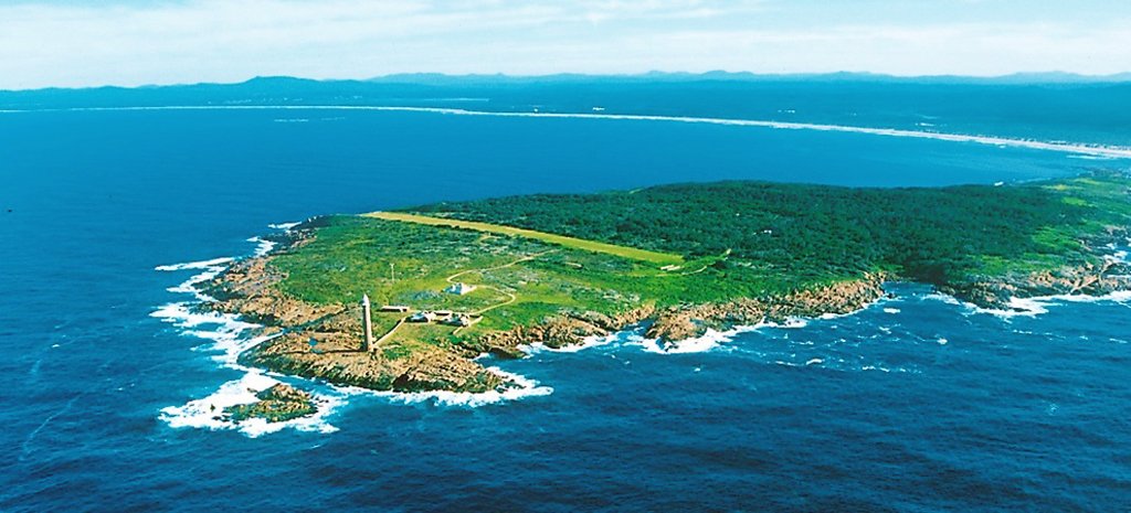
Gabo from the South East with Santa Barbara in the far right corner

These are just five of hundreds of Bass Strait anchorages that will keep you safe in the right conditions and refill your soul with an energy that sometimes is drained away by the daily grind of city life. Don’t trust anything that I have said in this article absolutely. Check it for yourself. Ask a fisherman, read the pilot book, research the weather… but when you’ve done that…do yourself a favour and get out there!