
Time and Tide
By David McNeice (custodian AKALA)
With a free wind and waves on the quarter, the old yacht eased north towards the entrance to Port Phillip, about three hours sailing time away. It is dark, but the sky is clear enough to see the moon bearing true north. The navigator, crusty old salt, informs the skipper they will arrive at the Rip at the flood slack and they can sail straight in. No tide tables were on board. How did the navigator know?
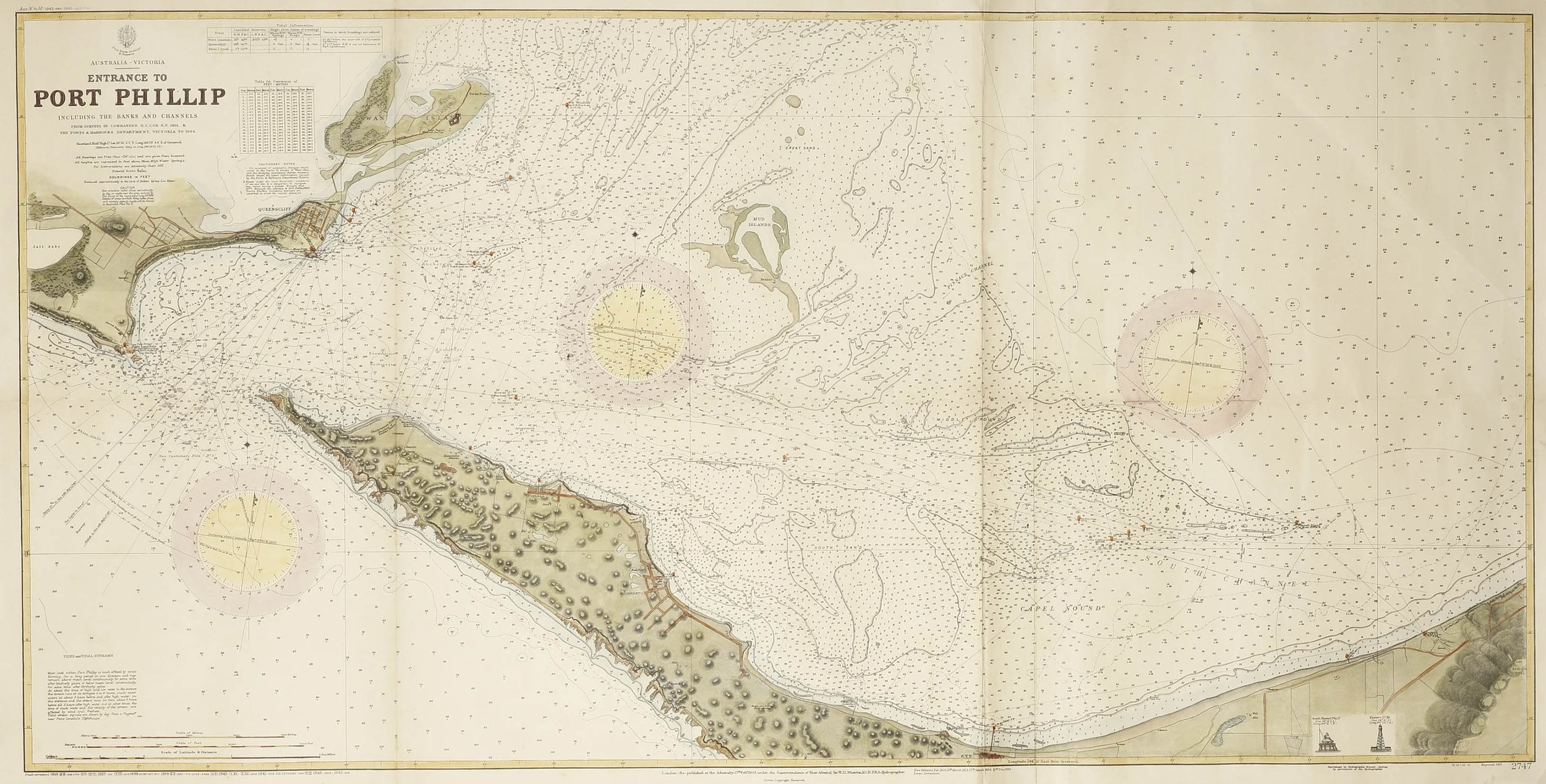
The 1970 edition of Sailing Directions (Victoria) is a volume that may be familiar to Port Phillip sailors of wooden yachts. It contains a table of lunar bearings for both high water and flood slack at the Rip. 316, that is NW, is the stated average azimuth (or bearing) of the moon for the flood slack over a month. In the three hours sailing time to reach the entrance, the moon's azimuth would decrease by approximately 45, from 360 to 315. The navigator had remembered the average azimuth and therefore had a rough and ready tide table in his head. The navigator held another average azimuth in his head: 65, or ENE. At that azimuth, the tide at the entrance to Port Phillip is at the ebb slack. But there is not usually much time between moonrise and it bearing ENE so it has less value as a predictor. Watching the moon sweep westwards across the sky to NW gives much more predictive value.
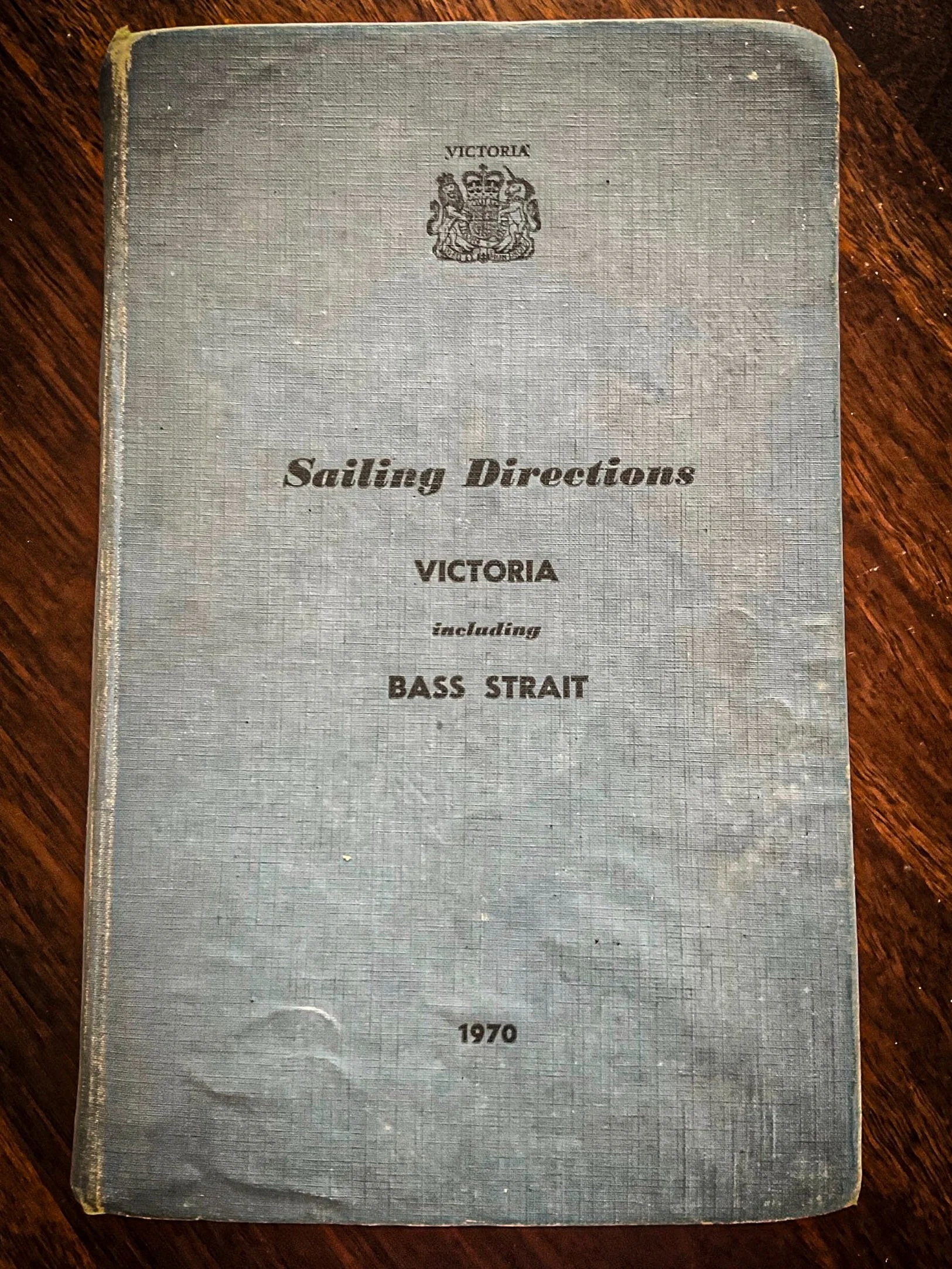
The modern editions of Sailing Directions no longer report such detail. The older editions had much more detail about tides, heights, time differences between ports etc. It shows the importance of knowing about the tides for safe navigation. Presumably the data is no longer printed because of its availability on internet sites. However, internet access is not always available and a back up method that has stood the test of time is desirable. Even remembering just one azimuth, NW, will be helpful.
But that bearing happens only once every day. The ENE azimuth confirms one of the ebb slacks but what about the other two slacks when the moon will not be visible? This is where you need the Nautical Almanac. There are generally two high and two low water tides each day around southeast Australia. This means there are four slack waters per day at the entrance to Port Phillip. By observation, the times of high and low water can be converted to a Local Hour Angle (LHA) of the moon and then converted to the Greenwich Hour Angle (GHA) for the given longitude. The time of the moon having that particular GHA is listed in the Almanac. LHA is the degree to which the moon (or any celestial body) has travelled west of the observer's meridian. LHA is measured westwards from 0 to 360. GHA is conceptually the same, but measured west of the Greenwich meridian.
To an observer in 1 E longitude, if the moon’s GHA is 1 then the LHA is 2. To an observer in 2 W longitude, the moon with GHA 1 has a LHA of 359. LHA is equal to GHA plus (or minus) east (or west) longitude. When the LHA of the moon is 30 to an observer at the entrance to Port Phillip (about 145E longitude), its GHA is 245. That will result in the moon bearing 316 on average (plus or minus 10 according to the Sailing Directions.) Look up the time in the Nautical Almanac when the GHA is 245, convert to local time and that gives the time of flood slack. The other flood slack occurs with a GHA of 70. The ebb slacks occur when the GHA is either 160 or 335. These GHA values are approximate. Actual times of slack water vary with the phase of the moon and its declination. Atmospheric pressure and wind conditions also have an effect.

The older versions of Sailing Directions also list time differences for tides at non standard ports. If you can work out the state of the tide at Point Lonsdale, then using the differences, which are stable, you can work out the tides at other places of interest, perhaps Westernport or Banks Strait. These guides to tide times using the lunar bearing or more completely the GHA will give satisfactory accuracy for passage planning. They will guide you to time of the ebb slack at the Rip which is perfect for entry when you want to ride the subsequent flood north up the West Channel. They will guide you to the time of the flood slack which is perfect for a yacht heading to Westernport. It is inherently more interesting to place tide times in the context of lunar bearings compared to the sterility of a table from an internet site.
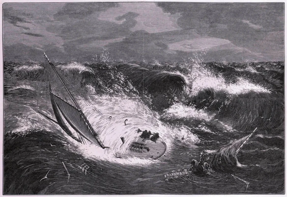
What happens when you get it wrong! On 15 July 1873 “The Rip” was overwhelmed by an enormous sea when proceeding through the infamous Port Phillip Heads. Wood engraving published in The Australasian sketcher August 9, 1873.
However, the analysis presented here is personal and neither the publisher nor the author take any responsibility for anyone relying on this data. You must do your own analysis and carry your own tide tables.